Bondhusvatnet Lake: Where It Is & How to Visit
Did you know that the trail to Bondhusvatnet was once used to transport glacier ice? In 1863, a road was built through the valley so horses could carry blocks of ice down to the fjord for export.
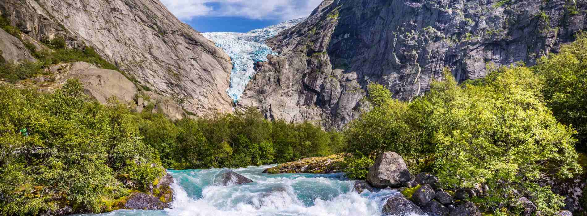
Today, this historic route leads to Bondhusvatnet, one of the most beautiful glacier lakes in Norway. Surrounded by steep mountains, waterfalls and the Bondhusbreen glacier, it’s also one of the easiest hikes in the Hardanger region.
Where Is Bondhusvatnet Lake in Norway?
Bondhusvatnet is located in Bondhusdalen Valley, near Sundal, in Kvinnherad municipality. It’s part of the Hardanger region in western Norway, approximately 20 minutes by car from Odda.
How Long Is the Bondhusvatnet Hike?
The hike is 4.6 km (2.9 miles) round trip and takes approximately two hours. The trail follows a wide gravel road with around 135–150 metres of elevation gain.
Is the Bondhusvatnet Hike Difficult?
No. It’s considered an easy hike and is suitable for families with children. The gravel road is also suitable for pushchairs. Powered wheelchairs may manage the route, although the uphill sections and gates can be challenging.
Can You Swim in Bondhusvatnet?
No. Swimming is prohibited because the lake supplies drinking water to the nearby villages of Bondhus and Sundal. Camping within 50 metres of the water is also prohibited.
Can You Walk to Bondhusbreen Glacier?
The easy, recommended hike ends at Bondhusvatnet, where you can see the glacier in the distance. Trails continue farther into the valley, but the terrain becomes more difficult and glacier-related hazards are possible. Always follow local safety signs.
What Is the Bondhusvatnet Hiking Trail Like?
The walk begins at Bondhusdalen car park, near Sundal, and follows a historic gravel road known as Isvegen, or the Ice Road.
The trail runs alongside the Bondhuselva River, passing green forests, waterfalls and impressive mountain scenery.
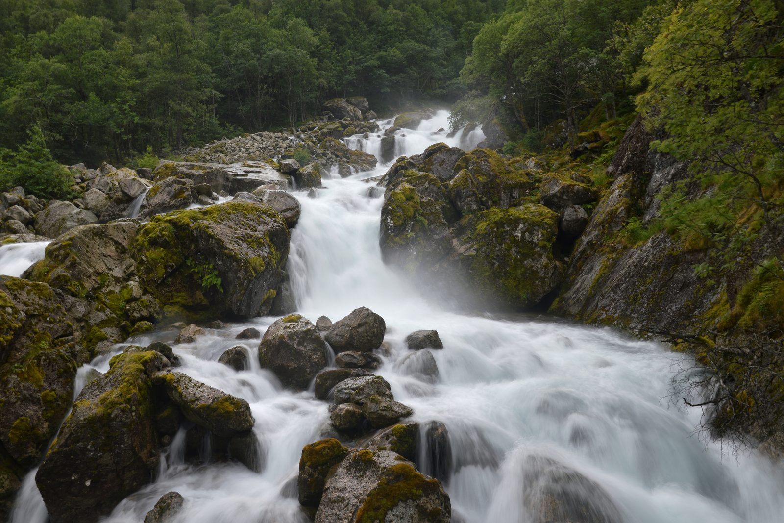
Although the route climbs gradually, it doesn’t require hiking experience. There are some gates along the way because animals graze in the valley. Remember to close them behind you.
After approximately 2.3 kilometres, you’ll reach Bondhusvatnet and a picnic area overlooking the lake.
The return follows the same path.
Why Is Bondhusvatnet Lake So Green?
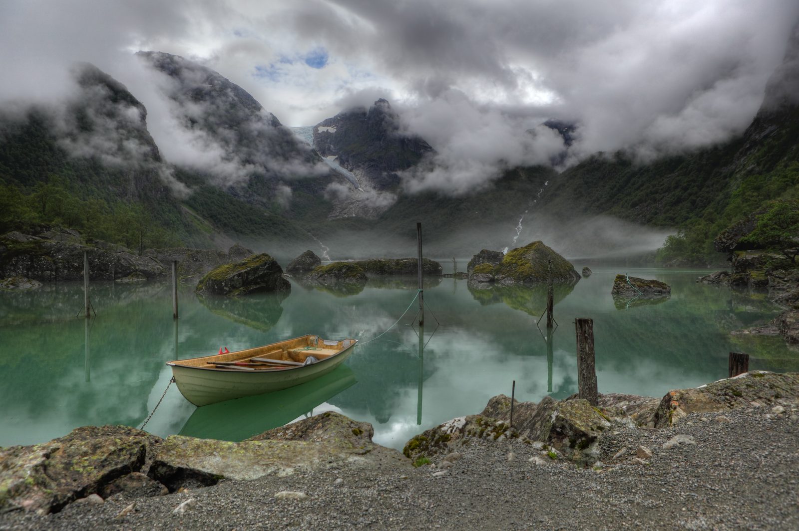
Bondhusvatnet is famous for its beautiful green water, which changes colour depending on the light and weather.
The colour comes from fine mineral particles carried by meltwater from Bondhusbreen, a glacier arm of Folgefonna.
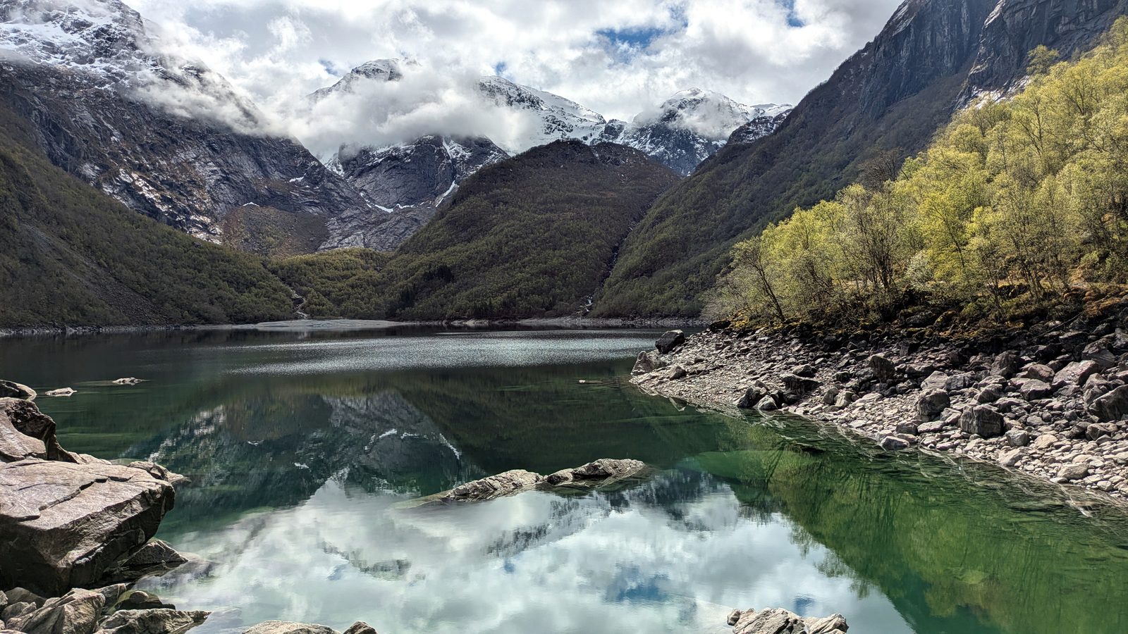
On clear days, the surrounding mountains reflect on the lake’s surface, creating one of Hardanger’s most photographed landscapes.
The glacier can still be seen at the far end of the valley, although it has retreated considerably over the past century.
Bondhusbreen Glacier and the Historic Ice Road
Bondhusdalen has attracted visitors since the 19th century.
In 1863, the Ice Road was built to transport ice from Bondhusbreen down to Maurangerfjord. Before modern refrigeration, glacier ice was an important product used to keep food and other goods cold.
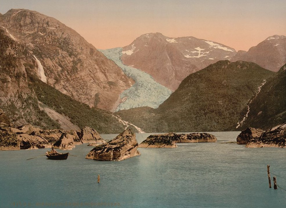
The same road is now the main hiking route to Bondhusvatnet.
The valley also has a special connection to Folgefonna National Park. In 2005, Queen Sonja officially opened the park here, and her signature can still be seen on a stone near the lake.
Today, Bondhusbreen lies much farther up the valley because of glacier retreat. Walking on the ice is not part of the Bondhusvatnet hike. Guided glacier experiences in the wider Folgefonna region require specialist equipment and a separate route.
How to Get to Bondhusvatnet
By car from Bergen — The journey takes approximately 2.5 hours, depending on traffic and ferry connections.
Drive towards Norheimsund and Tørvikbygd, then take the ferry to Jondal. Continue along Road 49 through the Jondal Tunnel towards Mauranger.
From Sundal, follow the signs to Bondhusdalen parking.
Check ferry timetables before leaving, as waiting times can affect the journey.
By car from Odda — Odda is approximately 20 minutes by car from Sundal.
Follow Road 49 through the Folgefonna Tunnel towards Mauranger, then continue to the Bondhusdalen parking area.
This is one of the easiest ways to visit Bondhusvatnet if you're staying in the Hardanger region.
By car from Rosendal — Rosendal is approximately 30 minutes by car from Bondhusvatnet.
Follow the road towards Mauranger and Sundal, then continue to the signed parking area.
Where to Park at Bondhusvatnet
The official Bondhusdalen car park is located near the start of the hiking trail.
Parking costs approximately 125 NOK per calendar day, according to the published 2026 rate. Check the current payment instructions when you arrive.
The access road is narrow, so drive carefully and use the designated parking spaces.
There are toilets and rubbish bins at the car park, but no toilets or rubbish bins along the trail.
Bring drinking water and something to eat if you plan to spend time by the lake.
When Is the Best Time to Visit Bondhusvatnet?
The best time to visit Bondhusvatnet is from late May to September, when the valley is green and walking conditions are generally easier.
July and August are especially popular, so arriving early can help you avoid the busiest hours.
The trail can also be visited in winter, but snow and ice may make the walk more difficult. Check the weather and local conditions before setting out.