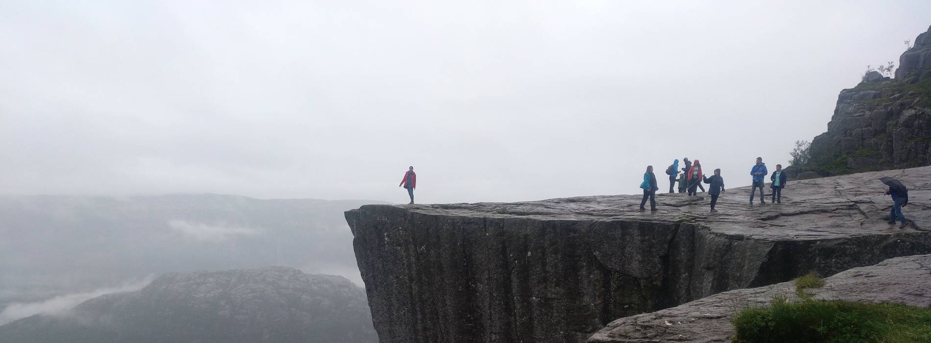
Hiking Kjerag, Norway: Everything You Need to Know
If you’re looking for an adventure that combines spectacular landscapes, a physical challenge and a good dose of adrenaline, Kjerag is the perfect destination.
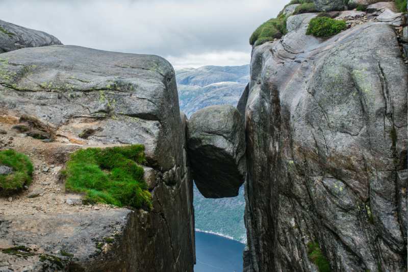
This iconic mountain, located in the Rogaland region of southwestern Norway, is famous for Kjeragbolten, a boulder wedged between two granite cliffs more than 1,000 metres above Lysefjord.
But Kjerag is much more than just this famous rock. It’s an unforgettable experience in the heart of Norway’s wilderness.
The formation of these incredible landscapes dates back to the last Ice Age, when enormous glaciers carved deep valleys into the mountains. As the glaciers melted, the valleys were flooded by the sea, creating the fjords we see today.
What Is Kjerag?
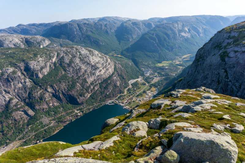
Kjerag is a mountain with a 1,084-metre-high cliff rising above Lysefjord, the same fjord where you’ll find Preikestolen.
Although it’s best known for the iconic Kjeragbolten boulder, it’s also a popular destination for adrenaline seekers, as the cliff is a famous BASE jumping location.
The views from the top are truly spectacular.
Where Is Kjerag Located?
Kjerag is located in the Rogaland region of southwestern Norway, near the village of Lysebotn.
Although it’s not as easy to reach as Preikestolen, the adventure is definitely worth the effort.
This impressive cliff is one of the most remarkable natural attractions in southern Norway.
What Is the Kjerag Hike Like?
The Kjerag hike is one of the most challenging trails in the area, but also one of the most spectacular.
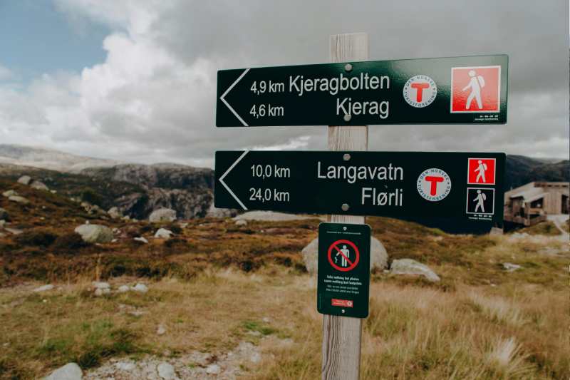
The trail is approximately 5 kilometres each way and involves considerable climbing. However, every effort is rewarded with unforgettable landscapes.
Here’s what to expect along the route:
-
Stage 1: Starting at Øygardstøl (Eagle’s Nest). The hike begins at Øygardstøl car park, also known as Eagle’s Nest. Right from the start, the trail climbs steeply over rocky terrain that can be slippery. Chains have been installed along some sections to help hikers during the ascent.
-
Stage 2: Steep climbs and descents. The route includes three main climbs separated by small valleys. Although the hike isn’t easy, the panoramic views of the mountains and Lysefjord make the effort worthwhile.
-
Stage 3: Reaching Kjeragbolten. After completing the climbs, you’ll finally arrive at the famous Kjeragbolten boulder. If you’re brave enough, you can step onto the rock for the iconic photograph. However, be extremely careful and never attempt it when the rock is wet or slippery.
How Long Does It Take to Hike Kjerag?
The complete hike, including the return journey, usually takes between 5 and 6 hours, depending on your pace and trail conditions.
It’s a demanding hike, so I’d recommend taking your time and enjoying the scenery along the way.
What Is the Weather Like on Kjerag?
The weather on Kjerag is quite unpredictable, as it is throughout much of Norway.
During summer, temperatures are generally more pleasant, but rain and fog are always possible, which can make the hike more difficult.
That’s why it’s important to bring waterproof clothing, suitable hiking boots and several layers so you can adapt to changing weather conditions.
When Is the Best Time to Hike Kjerag?
The best time to hike Kjerag is between June and September, when the trail is generally free of snow and weather conditions are more stable.
If you’re planning to visit outside this period, check the trail conditions carefully, as ice and poor visibility can make the hike dangerous.
How to Get to Kjerag from Stavanger
Getting to Kjerag from Stavanger can be an adventure in itself, combining different transport options with spectacular scenery.
Here are the main ways to reach the trail.
1. By Car
If you have your own car or a rental vehicle, this is the most flexible way to reach Kjerag.
From Stavanger, drive to Øygardstøl car park, where the hike begins.
The journey takes approximately 2.5 hours and includes the famous Lysevegen road, a spectacular mountain route with 27 hairpin bends.
The road is only open from approximately May to October, so make sure to plan your visit during the appropriate season.
2. By Lysefjord Cruise and Bus
Another spectacular way to reach Kjerag is by combining a fjord cruise with a bus journey.
Lysefjord cruise
From Stavanger harbour, you can take a cruise to Lysebotn, located at the far end of the fjord.
The journey takes approximately 2–3 hours and offers incredible views of the fjord, towering cliffs and waterfalls.
Some cruises also pass close to Preikestolen, allowing you to admire the famous cliff from the water.
Bus from Lysebotn to Øygardstøl
Once you arrive in Lysebotn, a bus can take you to Øygardstøl car park in approximately 20 minutes, where you can begin your hike to Kjerag.
This option combines adventure with beautiful landscapes and is ideal if you want to make the most of your visit to Lysefjord.
3. Join an Organised Tour
If you’d rather not worry about transport and planning, several companies offer organised excursions from Stavanger to Kjerag.
These tours usually include transport to Øygardstøl, and some also provide a hiking guide.
It’s a convenient option if you prefer a well-organised experience with someone who knows the terrain.
Are There Guided Tours to Kjerag?
Several tour operators organise excursions from Stavanger to Kjerag, including transport and a guide.
This is ideal if you don’t want to worry about logistics or would prefer to hike with someone familiar with the route.
Some excursions also combine the Kjerag hike with a boat trip through Lysefjord.
Is Hiking Kjerag Dangerous?
The Kjerag hike is physically demanding, and the terrain can be slippery, particularly after rainfall.
If you decide to step onto Kjeragbolten, you need to be extremely careful, as there are no safety barriers or protective measures on the boulder.
With the right equipment and precautions, the hike is manageable for people in good physical condition.
Make sure to wear hiking boots with good grip, carry enough water and bring clothing that protects you from wind and rain.
If you take the necessary precautions and have a reasonable level of fitness, the trail can be completed safely in suitable weather conditions.