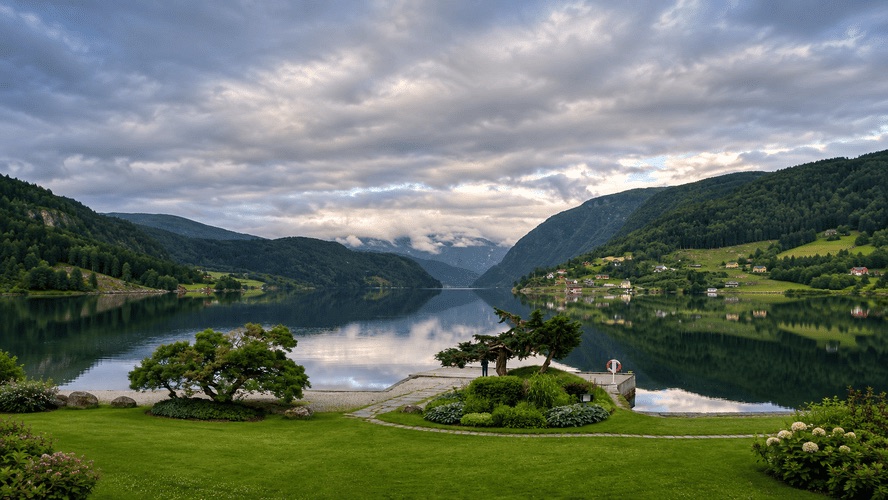
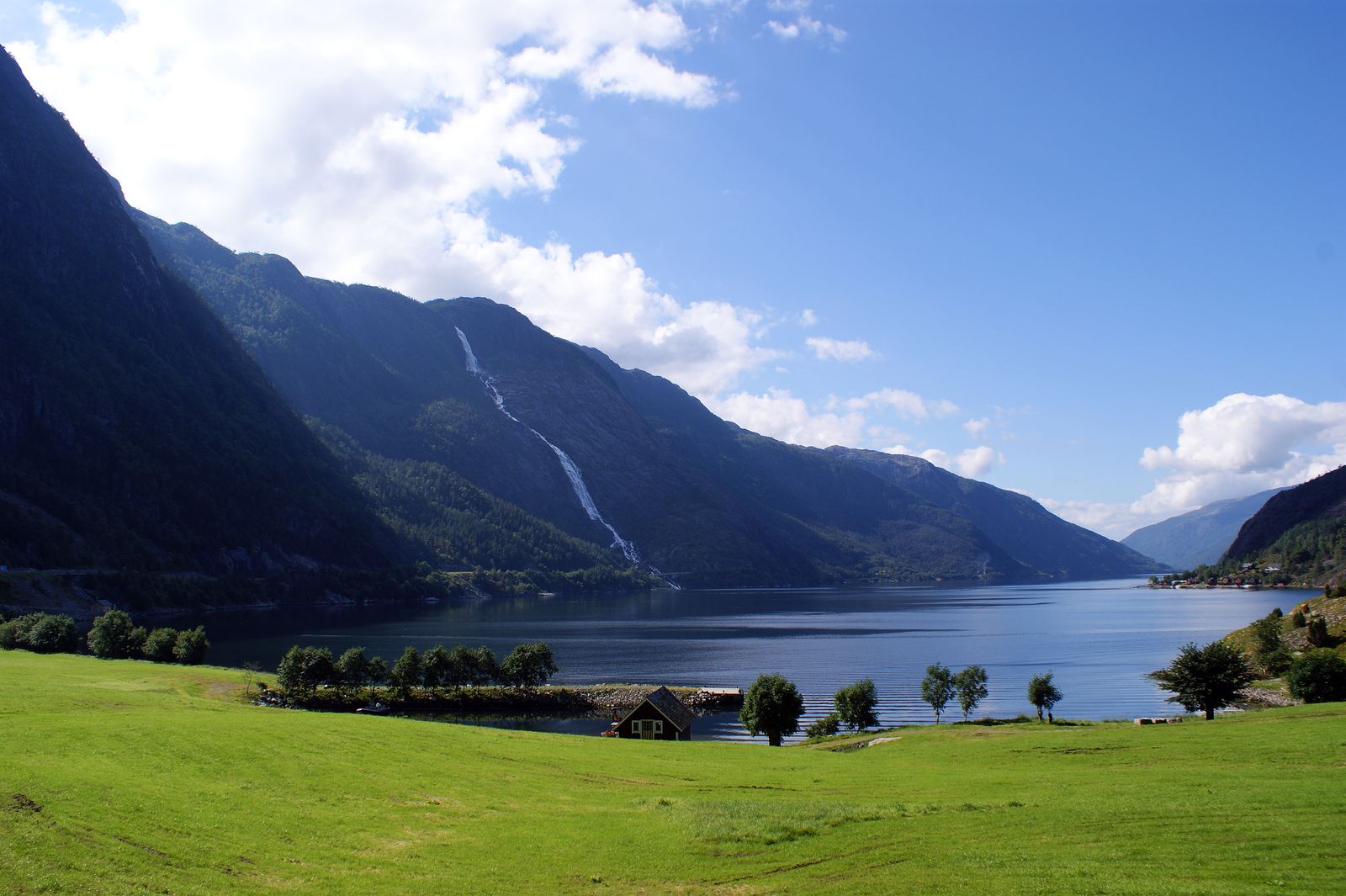
8 Best Things to See and Do in Eidfjord, Norway
Eidfjord is a municipality in Hardanger, in Norway’s Vestland region, located at the end of Eidfjorden, an inner branch of Hardangerfjord. In just a few hours of driving, you can travel from sea level to the mountain plateau of Hardangervidda.
The municipality covers approximately 1,492 km² and had 985 inhabitants in 2026. Nearly 90% of its land lies above 900 metres. Its highest point is on the Hardangerjøkulen glacier, on the border with Ulvik, which Kartverket measured at 1,851 metres in 2025. The highest rocky summit is Ramnabergnuten, at 1,729 metres.
Among its most impressive landscapes are Vøringsfossen waterfall, Kjeåsen mountain farm and the scenic road leading up to Hardangervidda. The village itself, with its stone church dating from 1309, can be explored on a short walk.
Here are 8 things to see and do in Eidfjord, ideal for a one- or two-day visit.
1. Admire Vøringsfossen Waterfall
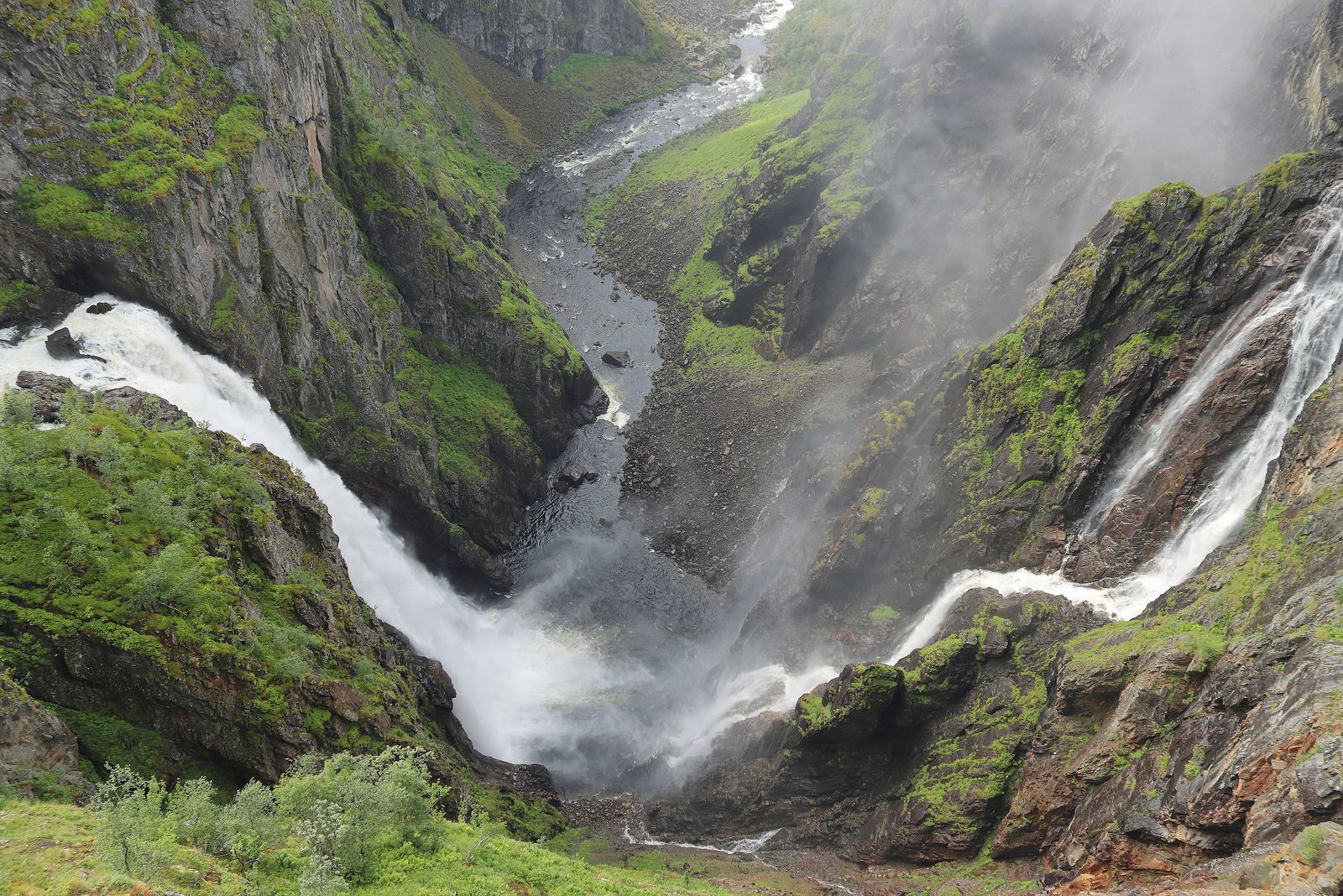
Vøringsfossen is Eidfjord’s most famous waterfall and one of the classic stops along the road between Oslo and Bergen.
The Bjoreio River plunges from the edge of the Hardangervidda plateau into the Måbødalen valley.
The waterfall has a total drop of 182 metres, divided into several sections. Its main drop was measured at 163 metres in 1893.
During the tourist season, a minimum water flow of 12 m³ per second is guaranteed because the river is regulated further upstream by Sysen Dam.
The name comes from the Old Norse Vyrðingr, associated with the verb “to appreciate” or “to revere”.
Outside the valley, the waterfall was almost unknown until 1821, when astronomer Christopher Hansteen visited the area on his way to the mountain plateau.
He estimated its height by throwing stones and counting the seconds with his pocket watch. His calculation gave a height of approximately 280 metres.
Seventy years later, a measurement using ropes established the actual height of the main drop.
From the viewpoint, you can also see another waterfall on the opposite cliff.
When the water flow is high, particularly during the snowmelt in May and June, the sound of the waterfalls is impressive.
Exploring the Vøringsfossen Viewpoints
Between 2018 and 2024, the Norwegian Public Roads Administration developed the area as part of the Hardangervidda National Scenic Route.
The project was designed by architect Carl-Viggo Hølmebakk.
In October 2026, the completed project received the Houen Foundation Diploma, one of Norway’s most prestigious architectural awards.
The area includes more than one kilometre of protected walking paths, several viewpoints, bridges and two service buildings.
Part of the site is wheelchair accessible. The Fossatromma parking area also has electric vehicle charging facilities.
One of the most impressive features is the staircase bridge crossing the Bjoreio River, just before the waterfall.
It has 99 steps, spans 47 metres and connects the two riverbanks across a height difference of 16 metres.
The bridge stands approximately 50 metres above the rapids.
The walking route that includes the bridge is around 500 metres long.
If you’d rather avoid the stairs, the old packhorse trail climbs to Fossli over approximately 525 metres, with 65 metres of elevation gain.
The toilets at Fossatromma and Fossli are generally open from early April until November.
During winter, parts of the viewpoint area close because of snow and ice.
Important: Never go beyond the safety railings. The cliffs have extremely steep drops.
You can find a map of the walking trails on the official Norwegian Scenic Routes website.
Fossli Hotel
The terrace at Fossli Hotel remains one of the best viewpoints for seeing Vøringsfossen directly from the front.
The hotel opened in 1891 and was designed by Frederik Konow Lund.
Building materials were transported from the village on horseback.
Norwegian composer Edvard Grieg visited the waterfall and had a cabin in the surrounding area.
Today, the hotel is also a popular place to stop for coffee while enjoying the views.
It’s worth checking whether the café is open on the day of your visit.
2. Explore Måbødalen Valley
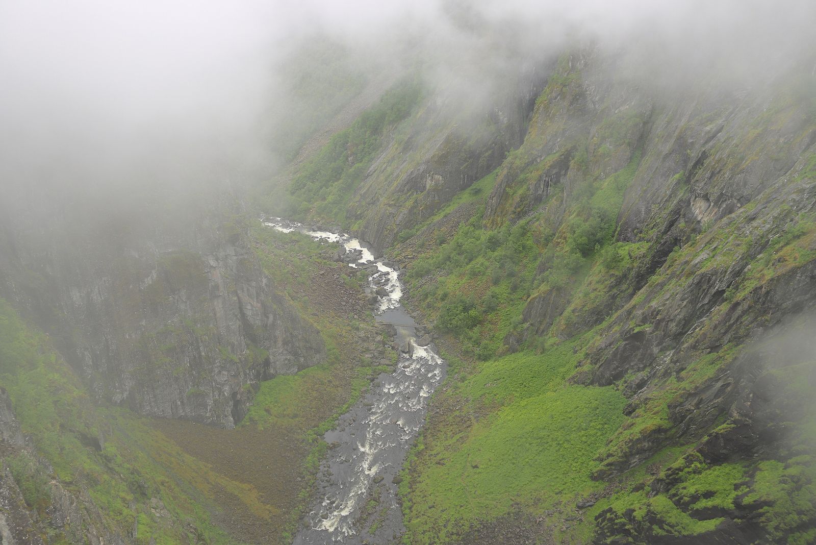
Måbødalen is the valley connecting Hardangervidda with the fjord.
The Rv7 road runs through it, passing through steep tunnels and sharp bends.
Even from the car window, you can appreciate the dramatic landscape, although the views are even better from the Vøringsfossen viewpoints.
Almost vertical cliffs rise above the river, while damp mountain vegetation covers parts of the slopes.
The Norwegian Scenic Routes project highlights this plant life as one of the natural features of the area.
The old road, which ran outside the tunnels, is now closed.
A major landslide damaged the route, and subsequent inspections by Statens vegvesen confirmed that the risk of further rockfalls remains high.
Although some people cross the barriers, the official recommendation is not to enter the closed road.
Cyclists and pedestrians are also prohibited from using the Rv7 tunnels in this section.
If you’re travelling by bicycle, the practical solution is to take a bus for this part of the journey.
In 1988, a bus left the road in this valley, killing 16 passengers from Sweden.
Today, the Rv7 passes through tunnels.
You can check current road conditions and temporary closures at vegvesen.no or by calling 175 in Norway.
3. Drive the Hardangervidda Scenic Route
The Hardangervidda National Scenic Route stretches for 67 kilometres between Eidfjord and Haugastøl, climbing from sea level to 1,251 metres.
This dramatic change in altitude defines the landscape of the municipality.
The road crosses the gently rolling mountain plateau before descending through the steep Måbødalen valley towards the village at the end of the fjord.
The route is open throughout the year, although there are some important exceptions.
During winter, it may close temporarily because of severe weather. Occasionally, sections are also closed to allow wild reindeer to graze undisturbed.
When snowfall is heavy, vehicles may have to travel in convoys behind snowploughs.
Always check the latest road conditions before setting off.
On clear days, you can see the outline of the Hardangerjøkulen glacier from the plateau.
The surrounding landscape is popular for hiking and fishing in mountain lakes.
Hardangervidda is also home to one of Europe’s largest wild reindeer herds.
If you encounter reindeer, observe them from a distance. They are protected wildlife.
Sysen Dam
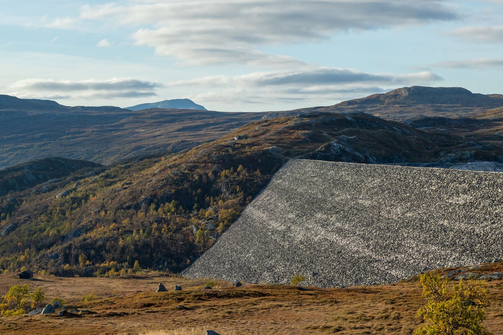
Sysendammen holds back the waters of Sysenvatnet, the reservoir that regulates the Bjoreio River before it reaches Vøringsfossen.
It’s a rockfill dam, and the reservoir has a capacity of approximately 427 million cubic metres.
The Rv7 road crosses the top of the dam.
It’s worth stopping here to admire the huge stone structure on one side and the open mountain plateau on the other.
Depending on the year, the landscape can display autumn colours surprisingly early or late in the season.
Water from Sysenvatnet, the Bjoreio River and the Isdølo River is carried through tunnels to the Sima Hydroelectric Power Station beside the fjord.
This explains why Vøringsfossen no longer has the natural flow of an unregulated river, apart from the guaranteed minimum flow during summer.
4. Visit Kjeåsen Mountain Farm
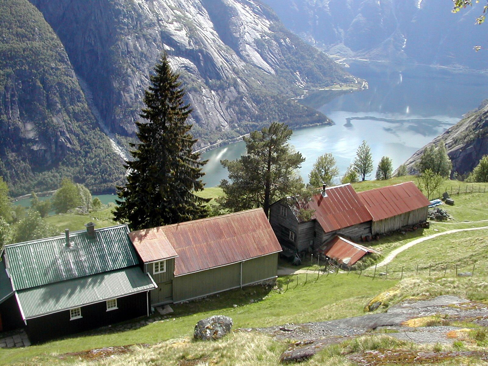
Kjeåsen consists of two farmsteads perched on a mountain ledge 513 metres above Simadalsfjorden, the innermost branch of the fjord.
For decades, the only way to reach the farms was along a footpath carved into the mountainside.
The farm became famous in Norway through the television series Der ingen skulle tru at nokon kunne bu, which tells the stories of people living in places where it seems almost impossible to live.
The farm is no longer actively worked, although people still live there during summer.
The grassy fields, traditional wooden houses and dramatic drop towards the fjord are the main attractions.
Today, Kjeåsen is visited as an outdoor viewpoint.
The Road and Hiking Trail to Kjeåsen
The road to Kjeåsen was built in 1974 as part of the hydroelectric development in the Sima valley.
It’s approximately 5 kilometres long, including around 2.6 kilometres through a single-lane tunnel.
Traffic is controlled by a timed system:
- Uphill traffic: On the hour.
- Downhill traffic: At half past the hour.
The schedule may change, so always read the signs at the tunnel entrance and never enter against the permitted direction of traffic.
Walking and cycling through the tunnel are prohibited.
If you’d like to reach Kjeåsen on foot, you must use the old hiking trail, which begins near the Sima power station.
The path is extremely steep and takes approximately 1.5–2 hours each way.
Because of the elevation gain, it’s best suited to experienced hikers comfortable with demanding mountain terrain.
Snow closes the road outside the warmer months, sometimes even at the beginning or end of summer.
Check that the road is open before travelling to Sima.
5. Discover Simadalsfjorden and the Sima Valley
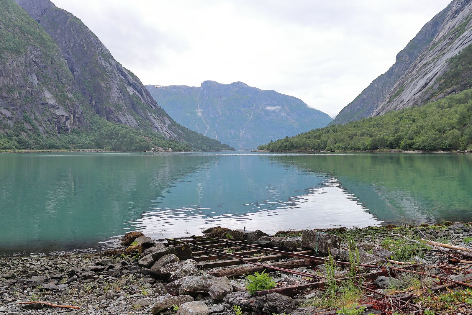
Simadalsfjorden is the most secluded extension of Eidfjorden.
The Sima valley stretches inland from the head of the fjord, with the Sima River, scattered farms and a hydroelectric power station built inside the mountain.
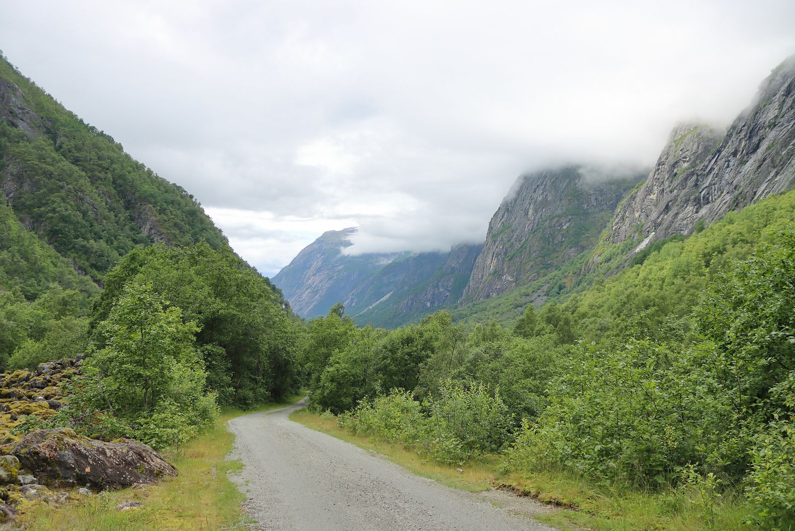
The road through the valley is narrow and simple.
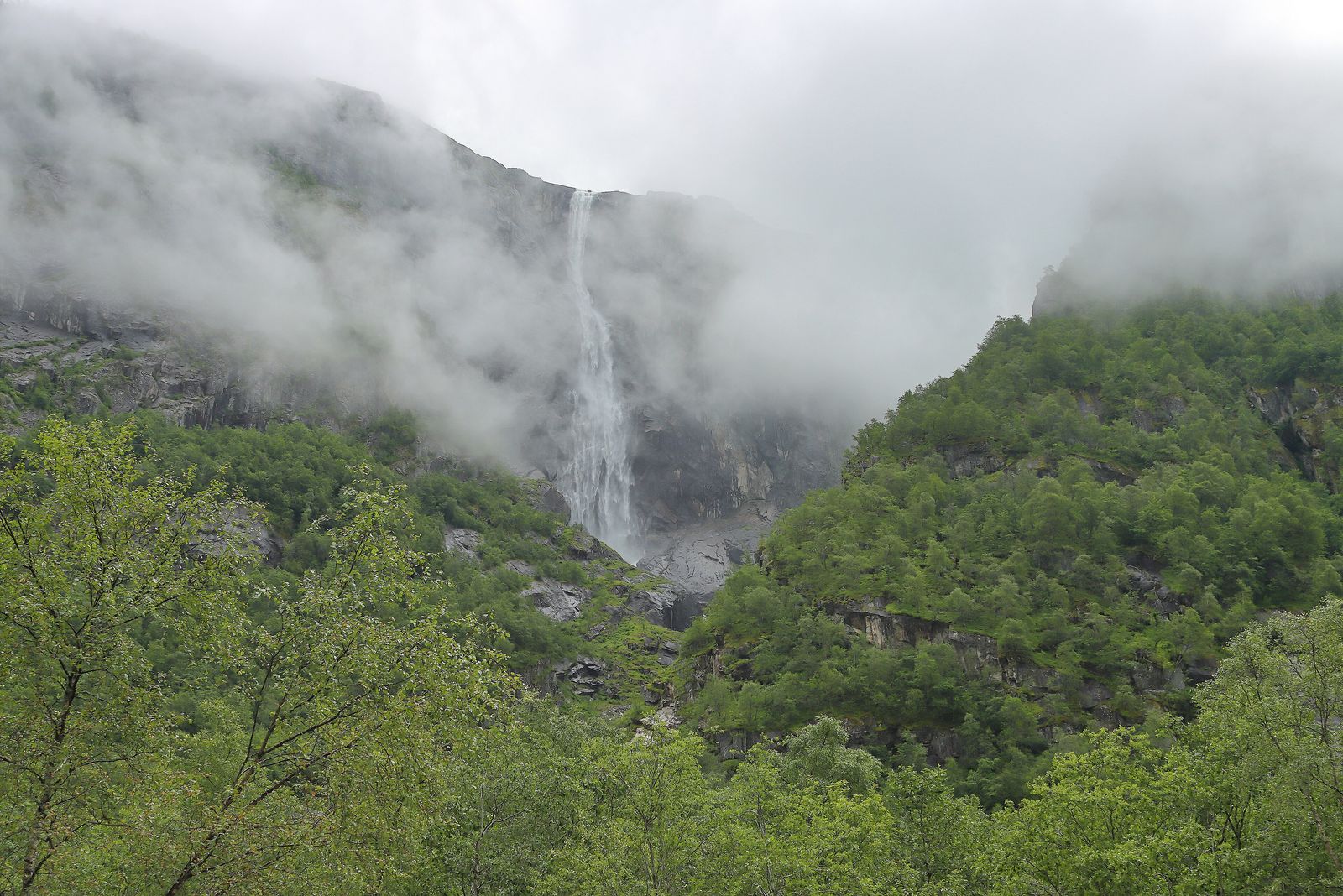
It provides access to the foot of Kjeåsen and offers views of Skytjefossen, a waterfall where the Skytjedalselva River plunges into Simadalen.
Unlike Vøringsfossen, Skytjefossen doesn’t have a developed network of viewing platforms.
You can admire it from the valley, although clouds and mist often hide part of the waterfall.
Sima Hydroelectric Power Station
The Sima Hydroelectric Power Station, operated by Statkraft, includes two major generating units:
- Lang-Sima: Approximately 500 MW.
- Sy-Sima: Approximately 620 MW.
They began operating in 1980 and 1981.
For many years, visitors could take guided tours of the power station, but these tours are no longer available.
In the village’s Millennium Park, a large Pelton turbine runner removed from the power station is now on display.
It’s an impressive piece of machinery and a reminder of the importance of hydroelectric power to Eidfjord’s economy, alongside tourism.
Further up the valley, Rembesdalsvatnet is one of the reservoirs in the hydroelectric system, located below the Hardangerjøkulen glacier.
It forms part of the high mountain landscape that can be seen from the scenic road.
6. Explore Eidfjord Village
The administrative centre of Eidfjord is located on an eidet, a narrow strip of land between the fjord and Lake Eidfjordvatnet.
This is where the name comes from: Eiðafjǫrðr, meaning “the fjord of the isthmus”.
The isthmus has two levels: Lægreid, the lower area, and Hæreid, the higher area.
The Eio River crosses this short stretch of land and is known for sea trout fishing.
Fishing requires a permit, and regulations change from season to season.
The village itself is small, with a harbour, a few shops and two churches.
When a cruise ship arrives, the centre often becomes busy by mid-morning before returning to its usual peaceful atmosphere in the afternoon.
Eidfjord has a deep-water quay designed to accommodate cruise ships.
A little further south, beside the lake, is Øvre Eidfjord, where you’ll find the nature centre and the road leading towards Måbødalen.
The Old Stone Church of Eidfjord
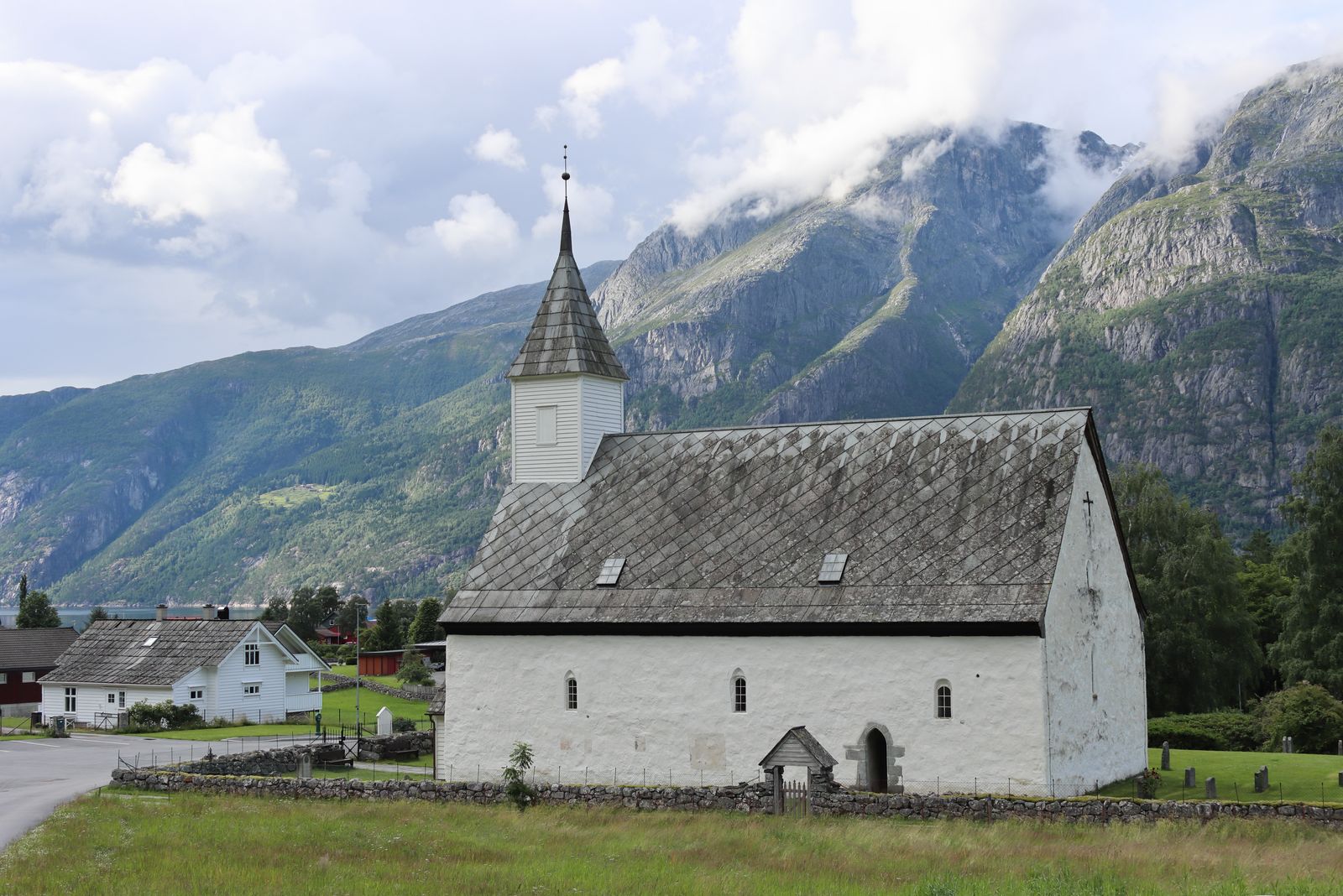
Eidfjord Old Church (Eidfjord gamle kyrkje) is a stone church dating from 1309, located beside Lægreid farm.
Its long nave, slate roof and white wooden bell tower are easily recognisable from the cemetery fence.
The new church, built in 1981, is the parish’s main place of worship.
Between May 1 and August 31, the parish tries to open the old church whenever possible, particularly on days when cruise ships visit Eidfjord.
You can check actual opening hours on the parish website.
Hæreid Viking Burial Mounds
On the Hæreid terrace above the village, you’ll find approximately 300 burial mounds and stone cairns dating from the Iron Age, including graves from the Viking Age.
It’s one of the largest burial sites of its kind in western Norway.
You can explore the area by walking across a grassy hilltop dotted with ancient stone mounds, with views of the fjord below.
Eidfjord’s municipal coat of arms, approved in 1984, features silver reindeer antlers against a blue background.
It reflects two resources that have long supported life in the area: reindeer hunting on the mountain plateau and the rivers flowing from the ice towards the fjord.
7. Visit Norsk Natursenter Hardanger
In Øvre Eidfjord, at Sæbøtunet 11, you’ll find Norsk Natursenter Hardanger, the visitor centre associated with Hardangervidda National Park.
It opened on May 28, 1995, in the presence of Queen Sonja, under its original name, Hardangervidda Natursenter.
The exhibitions explore reindeer, the mountain plateau, hunting, fishing and the relationship between the natural landscape and the people who depend on it.
The regular opening season runs from April 1 to October 31, from 10 AM to 6 PM.
Groups can arrange visits during the rest of the year.
Check the official website before planning your stop, as opening dates and hours may change.
Hardangervidda National Park covers approximately 575 km² of Eidfjord municipality, around 38% of its total area.
Another part of the municipality, towards the north and east, belongs to the Skaupsjøen and Hardangerjøkulen Landscape Protection Area.
Together, these protected areas cover almost three-fifths of the municipality.
If you’re arriving from Bergen and only have an afternoon, a practical order is to visit Eidfjord village, Norsk Natursenter and Vøringsfossen.
All three attractions are located along the same road.
8. Hike Across Hardangervidda and the Veig Valley
The part of Hardangervidda within Eidfjord is the more rugged section of the plateau, rather than the vast, relatively flat landscape found further east.
The Norwegian Trekking Association (DNT) maintains hiking trails and mountain cabins throughout the area.
One of the classic historical routes heading east is Nordmannsslepa, an ancient trail that crossed the plateau towards Numedal.
This is terrain suited to long day hikes or multi-day trips, with weather conditions that can change dramatically within an hour.
You can find maps and weather information on UT.no and through DNT.
The Veig River and Hjølmadalen
South of Lake Eidfjordvatnet, the Veig River flows through Hjølmadalen, entering the valley via Valursfossen waterfall.
Unlike the Bjoreio River, the Veig is protected and isn’t used for hydroelectric power generation.
It’s a quieter alternative to Vøringsfossen, with fewer developed viewpoints, fewer tour buses and a valley recognised for its natural scenery in the municipality’s planning documents.
Marked hiking routes can change depending on snow conditions, so it’s important to check current trail maps rather than relying on an old printed guide.
How to Plan Your Visit to Eidfjord
Eidfjord’s main attractions are spread across three different elevations: the village and fjord, the mountain ledge at Kjeåsen and the Hardangervidda plateau.
Trying to see everything in a single afternoon would leave very little time to appreciate each place.
Route 1: An Afternoon in Eidfjord
This route works well if you’re arriving from Bergen and continuing your journey, or if your cruise ship is stopping for just a few hours.
Start at the old church in Lægreid and the harbour.
Then head to Øvre Eidfjord, visit Norsk Natursenter if it’s open and finish at the Vøringsfossen viewpoints.
Allow enough time for the journey back down, as traffic through the Måbødalen tunnels can be slow when cruise excursions are operating.
Route 2: A Full Day with an Overnight Stay
Add Kjeåsen in the morning, before queues build up at the tunnel.
In the afternoon, visit Sysen Dam.
If the weather remains good, continue along part of the Hardangervidda plateau towards Haugastøl and turn back before the light begins to fade.
You can combine Simadalen and Skytjefossen with Kjeåsen, as they share the same access road until the base of the tunnel.
Route 3: Two Days with a Hike
Spend the second day exploring the Veig Valley or walking along a section of the Hardangervidda plateau, depending on your fitness level and the weather forecast.
A half-day hike starting from the scenic road, with a DNT map and waterproof clothing, is enough to get a good introduction to the landscape.
How to Get to Eidfjord
By car — Driving is the easiest way to visit the waterfall, mountain farm and plateau in the same day.
From Bergen, cross the Hardanger Bridge, which opened on August 17, 2013, replacing the former ferry connection between Bruravik and Brimnes.
Then follow the Rv7 towards the end of the fjord.
The journey takes a little over two hours, depending on traffic.
From the east, the same Rv7 connects Oslo with Eidfjord via Hardangervidda.
During winter, this mountain section may be temporarily closed or require vehicles to travel in convoys.
The Rv13 joins the Rv7 near the fjord, continuing towards Odda in one direction and Voss in the other.
By bus and train — Eidfjord doesn't have a railway station.
The Bergen Railway crosses the mountain plateau further east, with stops at Finse and Haugastøl.
From Haugastøl, the Rv7 continues west towards Eidfjord, with transport connections depending on the season.
Local buses are operated by Skyss.
Connections with Bergen, Voss and routes across the mountain plateau vary depending on the day and snow conditions.
You can plan journeys using Entur, Norway's public transport journey planner.
For more transport options, see our guide to getting around Norway.
If you're travelling by bicycle, remember that the Måbødalen tunnels are closed to cyclists, and the old road remains inaccessible.
You'll need to use a bus to travel through this section.
By cruise ship — Several cruise ships stop at Eidfjord as part of their Hardangerfjord itineraries.
Onboard excursions usually focus on Vøringsfossen.
If you're exploring independently and a large cruise ship is in port, consider visiting the waterfall early or waiting until the organised groups have returned.
When Is the Best Time to Visit Eidfjord?
May to September is the best period for combining several activities in Eidfjord.
May and June
Spring brings melting snow and some of the strongest water flows at Vøringsfossen and Skytjefossen.
However, snow may still cover the mountain plateau, and the road to Kjeåsen may open later in the season.
July and August
These months offer long daylight hours, extended opening times at the nature centre and more predictable access to Kjeåsen.
They’re also the busiest months for cruise ships and traffic around the viewpoints.
September and October
In September, the mountain plateau begins to change colour, and there are fewer visitors.
The nature centre closes at the end of October.
After that, Vøringsfossen can still be admired from the viewpoints that remain open, although parts of the viewing area close until spring.
Winter
During winter, Eidfjord village can still be reached by the road along the fjord.
However, travelling across Hardangervidda is a different experience, with possible convoy driving, temporary road closures and strong winds.
Mountain hiking at this time of year requires winter equipment and experience.
Rain is common in every season, so always bring a waterproof jacket.
It’s much better to carry one than to have to turn back at Fossli because of bad weather.
Sources and Useful Links
- Eidfjord Municipality
- Eidfjord — Store norske leksikon
- Vøringsfossen — Norwegian Scenic Routes
- Hardangervidda Scenic Route
- Norsk Natursenter Hardanger
- Visiting Eidfjord’s Churches
- Hiking Trails — DNT and UT.no
- Road Conditions — Statens vegvesen
- Transport Timetables — Entur
- Vestland Bus Services — Skyss