8 Best Things to See and Do in Askvoll, Norway
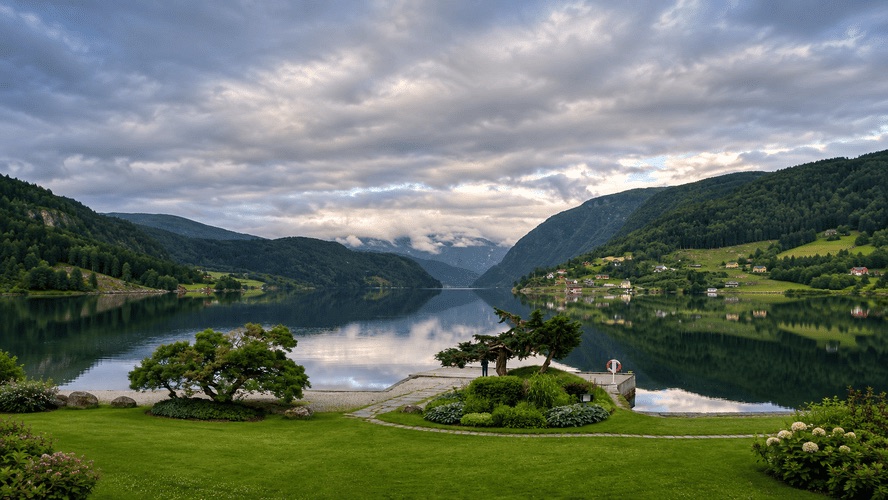
Askvoll is a municipality on Norway’s western coast, in the Vestland region, between Dalsfjorden and Førdefjorden. Its landscape combines small fishing villages, mountains rising directly from the sea and an extensive archipelago of islands and islets.
Unlike some of the more famous destinations in the Norwegian fjord region, Askvoll has a peaceful atmosphere where fishing, sailing and coastal traditions are still part of everyday life.
Its main attractions include the islands of Værlandet and Bulandet, Mount Alden and the natural landscapes of Atløy. You’ll also find historic churches, former industrial settlements and hiking trails with beautiful sea views.
If you’re exploring the Vestland coast, here are 8 places to see and things to do in Askvoll, along with practical tips to help you plan your visit.
1. Explore the Islands of Værlandet and Bulandet
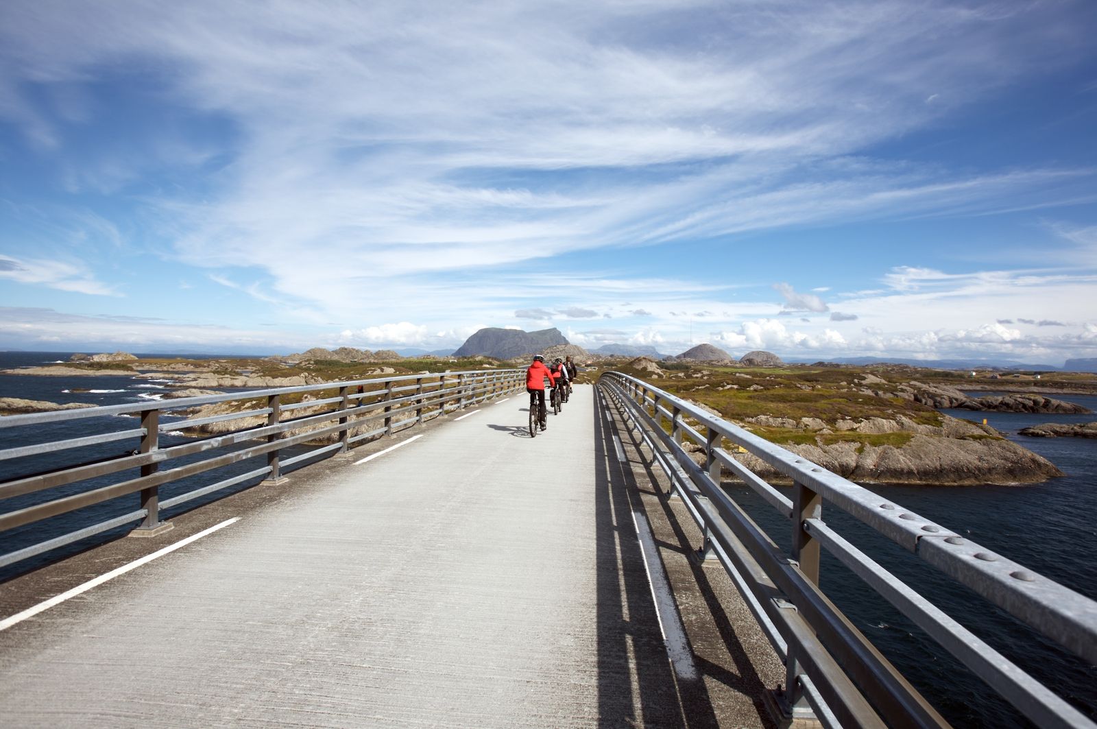
West of Askvoll lies the Værlandet and Bulandet archipelago, considered Norway’s westernmost group of inhabited islands.
The landscape consists of hundreds of small islets, narrow sea channels, wooden houses and traditional fishing harbours. It’s one of the most interesting places in the municipality to discover life along the Norwegian coast.
The two communities are connected by Nordsjøporten, a scenic road crossing six bridges, allowing visitors to explore the archipelago without needing a boat between the main islands.
The route between Værlandet quay and Bulandet is approximately 11 kilometres long and offers views of the ocean, small bays and countless islands scattered across the horizon.
Things to Do in Værlandet and Bulandet
One of the best ways to explore the archipelago is by bicycle. The terrain has moderate slopes and very little traffic, making it easy to cycle at a relaxed pace and stop at the viewpoints along the way.
You can rent bicycles from the Joker supermarkets in Værlandet and Bulandet, with the option of collecting a bike at one location and returning it at the other.
The ride usually takes around two hours, including stops.
Besides cycling, there are several other interesting activities:
- Hiking: The Nordsjøløypa coastal trail crosses different natural landscapes and leads to viewpoints overlooking the sea.
- Kayaking: The waters surrounding the islands are ideal for exploring small bays and channels between the islets.
- Wildlife watching: Sørværet Nature Reserve, on Værlandet, protects a coastal environment visited by seabirds and other wildlife.
- Fishing heritage: The exhibition Bulandet i fortid og notid explores how life on the islands has changed and the importance of fishing to local communities.
It’s also worth visiting Gjørøy Lighthouse in Bulandet, which can be reached by a short coastal walk.
How to Get There
Ferries depart from Askvoll harbour to Værlandet.
The crossing takes approximately one hour, and vehicles can be taken on board.
I’d recommend spending at least half a day on the islands, although a full day is ideal if you want to explore them without rushing.
You can find more information about cycling routes and bicycle rentals on the Fjord Norway website.
2. Admire Mount Alden, the Norwegian Horse
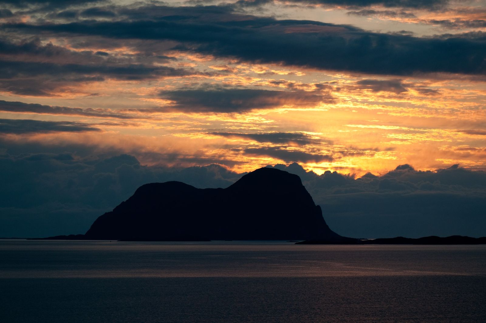
Alden is one of the most recognisable mountains on Norway’s western coast.
Located on a small island between Atløy and Værlandet, it rises dramatically from the ocean to a height of 481 metres.
Its distinctive shape has earned it the nickname Den norske hest, meaning “the Norwegian Horse.”
For centuries, the mountain has served as a landmark for sailors navigating the coast. On clear days, it can be seen from more than 100 kilometres out at sea.
Hiking to the Summit of Alden
The hike begins near the island’s small quay, where a trail climbs the mountainside.
The first section is quite steep, but at approximately 300 metres above sea level, you’ll reach a plateau where the terrain becomes gentler.
From here, the trail continues towards Instestova, on the eastern side, offering 360-degree panoramic views of the surrounding coastal landscape.
You can also continue towards Ystenova, at the western end, for beautiful views of the Værlandet and Bulandet islands and the open ocean.
On clear days, you can see some of Sunnfjord’s most distinctive mountains, as well as the Ålfotbreen and Gjegnalundbreen glaciers.
The hike is approximately 5.2 kilometres round trip and takes around three hours.
It’s classified as a moderate hike, although the initial climb requires some experience walking on mountain terrain.
How to Get to Alden
The island doesn’t have a regular passenger ferry service.
To reach it, you’ll need to arrange a boat transfer from Værlandet or use your own boat.
The best time for the hike is between spring and autumn, provided the weather conditions are suitable.
During winter, snow and ice can make the climb considerably more difficult.
If you prefer not to hike, you can still admire Alden’s distinctive silhouette from the bridges and viewpoints around Værlandet and Bulandet.
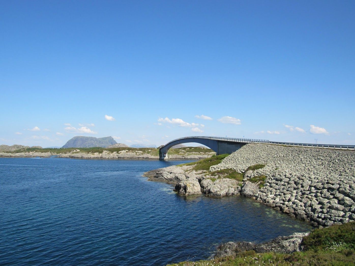
You can find more information about the hike on the official Fjord Norway website.
3. Discover Atløy Island and Vilnes Church
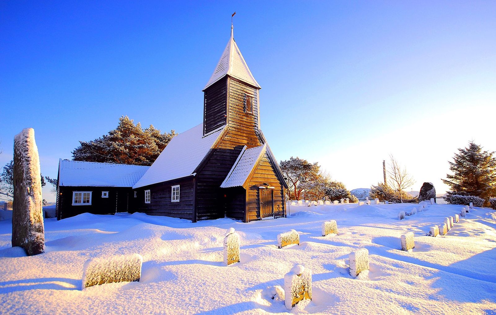
Atløy is one of the main islands in Askvoll, located opposite the village that gives the municipality its name.
The island combines small villages, farmland, rocky coastlines and mountains offering views of the surrounding islands.
The most common way to reach Atløy is by taking the ferry from Askvoll to Gjervik, a crossing of approximately 10–15 minutes.
A good way to explore the island is to cycle along the 11.6-kilometre road connecting Gjervik and Herland, stopping at its main attractions along the way.
Vilnes Church
One of Atløy’s most important historic landmarks is Vilnes Church (Vilnes kyrkje), a wooden church built in 1674.
It’s located in the eastern part of the island, surrounded by a small cemetery and overlooking the fjord.
The building preserves the traditional architecture of rural churches along the Norwegian coast, with a simple wooden structure and a bell tower standing out against the landscape.
Although you can admire the exterior throughout the year, access to the interior depends on the parish’s opening hours.
Brurastakken: A Mountain with Unusual Geology
In western Atløy, you’ll find Brurastakken, a mountain famous for its striking bands of black, white and green rock.
These bands, visible even from the sea, are the result of complex geological processes that shaped the region over hundreds of millions of years.
Its slopes reveal evidence of three ancient mountain-building events, making Brurastakken a particularly interesting destination for geology enthusiasts.
A marked geological trail begins approximately two kilometres from Herland and leads towards the mountain.
From the higher sections, you’ll enjoy views of the islands, fjords and ocean.
The route is relatively short and classified as easy, although suitable footwear is recommended for walking on natural terrain.
Other Places to Visit on Atløy
The island also has hiking trails leading to Skredvarden, its highest summit, at 636 metres above sea level.
In Leirvåg, ancient rock carvings have been discovered, showing that people inhabited the island during the Bronze Age.
If you have enough time, Atløy is a great place to spend a day combining nature, historical sites and small coastal villages.
4. Walk Through Askvoll Village
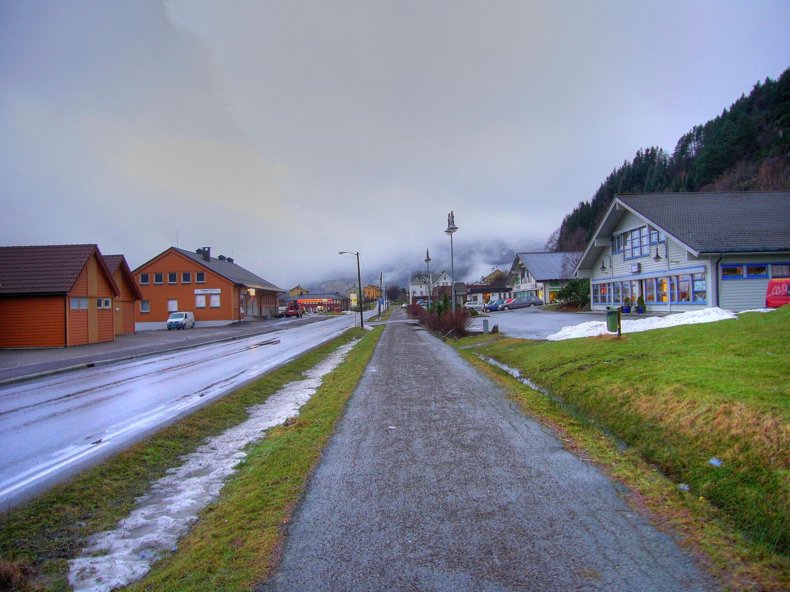
Askvoll village is the municipality’s main settlement and administrative centre.
Located beside the sea, it has a small harbour, shops, restaurants and accommodation.
It’s also the departure point for ferries connecting the mainland with Atløy, Værlandet and Bulandet.
Although Askvoll doesn’t have major monuments and doesn’t require a long visit, it’s worth walking through its streets and heading towards the quay to enjoy views of the fjord and surrounding mountains.
Askvoll Church
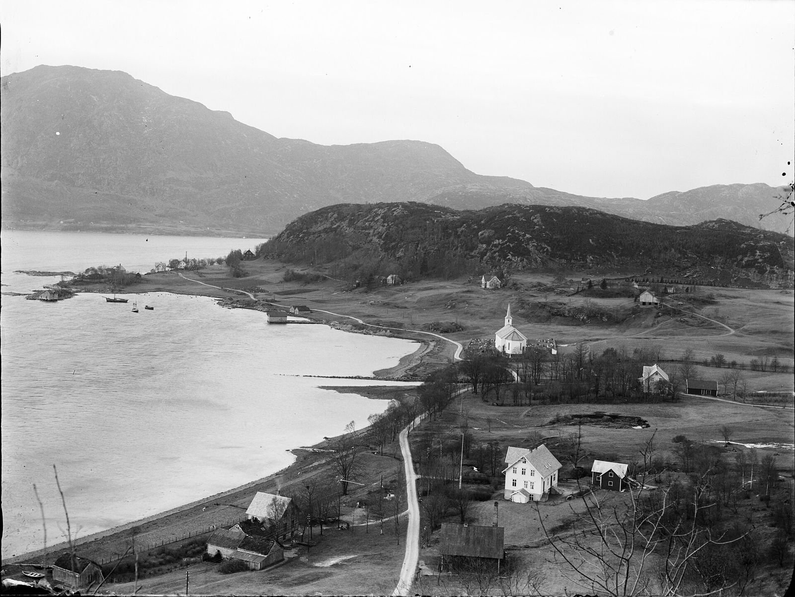
One of the village’s most important historical buildings is Askvoll Church (Askvoll kyrkje), a wooden church built in 1863.
The church stands on a site used for religious purposes since the Middle Ages, when a church and a parsonage already existed here.
Its white architecture and coastal location make it one of the village’s most recognisable buildings.
Anders Askevold Cultural Trail
Askvoll is also the birthplace of Anders Askevold (1834–1900), a Norwegian painter known for his depictions of rural landscapes and scenes of farming life.
A cultural walking route through the village connects places associated with his life and work.
The trail is approximately 3 kilometres long, with 11 stops, and finishes beside the monument dedicated to the artist at Korseberget, near the church.
Through the Kulturvandring website, you can access explanations, photographs and information about each stop on your mobile phone.
It’s an interesting way to discover Askvoll’s past while exploring the village and its surroundings.
5. Visit Holmedal and Discover Its Connection to Iceland
Holmedal is a small village beside Dalsfjorden, surrounded by mountains and farmland.
Although it’s a peaceful place, it has two interesting attractions connected to Norwegian craftsmanship and the history of the first Norse settlements in Iceland.
Helle Knife Factory
Holmedal is home to Helle Knivfabrikk, a traditional factory specialising in outdoor knives.
The company is known for combining traditional craftsmanship with designs inspired by nature and the needs of hikers, hunters and other outdoor enthusiasts.
The factory has a shop where visitors can purchase its products and learn about the company’s history.
If you’re interested in visiting, check the opening hours on Helle’s official website, as they may vary by season.
The Statue of Ingólfur Arnarson in Rivedal
Very close to Holmedal lies Rivedal, a small village connected to one of the most important figures in Icelandic history.
According to the Norse sagas, Ingólfur Arnarson was the first Norse settler to establish a permanent settlement in Iceland, around the year 874.
Tradition places his origins in Rivedal, from where he is believed to have departed for the North Atlantic.
To commemorate this history, a replica of the statue dedicated to the explorer in Reykjavík was erected here in 1961.
The monument stands beside the road connecting Holmedal and Dale, surrounded by mountains and fjord scenery.
It’s a short but interesting stop if you’d like to learn more about Viking history and Norse expeditions across the Atlantic.
6. Discover the Industrial Heritage of Stongfjorden
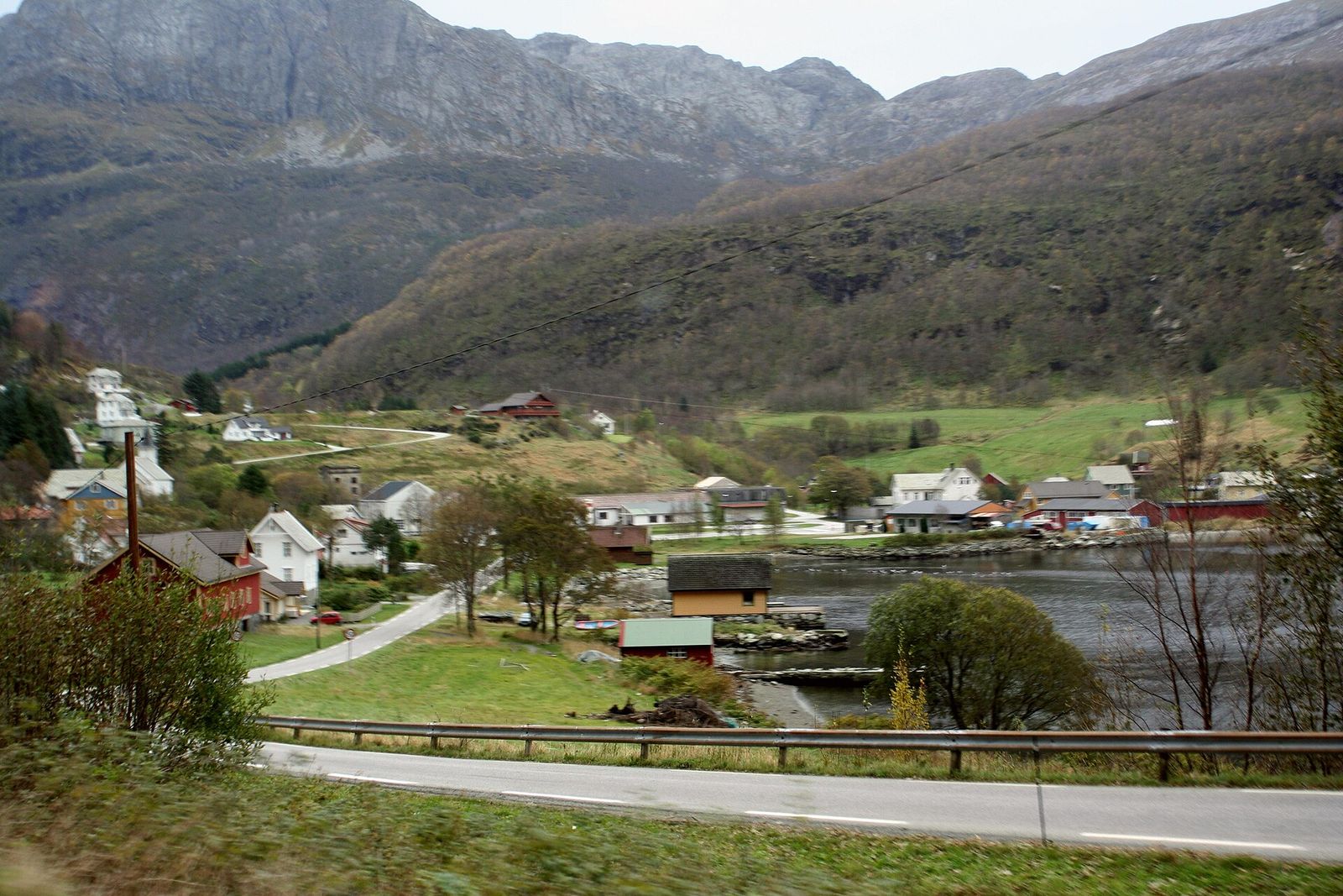
Stongfjorden is a small village north of Askvoll, surrounded by mountains and situated beside a narrow fjord.
Its historical importance is connected to the early industrialisation of Norway.
At the beginning of the 20th century, one of northern Europe’s first aluminium production plants was established here, beginning operations around 1907–1908.
The industry made use of the area’s hydroelectric resources and transformed the village, attracting workers and encouraging the construction of housing and public services.
Aluminium production continued until 1945, leaving behind an important industrial heritage.
Stongfjorden Cultural Trail
Today, you can discover the village’s history along a cultural walking route of approximately 1.2 kilometres, with nine stops.
The trail passes places associated with the former factory, the hydroelectric power station and other facilities used by workers.
Information boards and digital content explain how the industry operated and how it changed the lives of local residents.
The walk takes approximately 40 minutes and offers an insight into a less touristy but fascinating part of Norwegian history.
You can also visit the interpretation centre in Stongfjorden, associated with the Fjordkysten Geopark, to learn more about the region’s geology and industrial heritage.
The Stavenes Rock Carvings
Near Stongfjorden lies Staveneset, a coastal headland where several groups of Bronze Age rock carvings have been discovered.
The figures, carved into rock surfaces, mainly depict boats, although there are also representations of people, animals, weapons and carts.
They are among the oldest examples of human activity in this part of the Norwegian coast.
The archaeological sites are outdoors, close to the road, with signs to help visitors find them.
The carvings can be difficult to see under certain lighting conditions. It’s important to observe them without touching or damaging the rock surfaces.
The Former Grimelia Mines
Another place connected to Askvoll’s industrial heritage is Grimelia, beside Førdefjorden.
Copper mining took place here during different periods between 1759 and 1920.
Although mining ended more than a century ago, remains of the old facilities and extracted materials can still be found.
The site is mainly of historical and scenic interest. It’s not a developed tourist mine where visitors can explore the underground tunnels.
7. Hike Blåfjell and Blegja
Askvoll offers numerous mountain hiking trails with panoramic views of the fjords and surrounding archipelago.
Two of the best-known peaks are Blåfjell and Blegja, although they have very different difficulty levels.
Blåfjell: Panoramic Views Over Askvoll
Blåfjell is a 533-metre mountain located north of Askvoll village.
The trail starts at Askvoll Øvre car park and climbs gradually through forest and open terrain.
The first 800 metres follow the same trail as the route towards Sandvika.
After that, the path continues uphill, passing the tree line and reaching the mountain’s upper slopes.
From the summit, you’ll enjoy excellent views of Askvoll, the nearby fjords and the islands stretching towards the ocean.
The route is approximately 2.4 kilometres uphill, with around 500 metres of elevation gain.
Although it isn’t particularly long, it’s classified as demanding because of its steep gradient.
Allow approximately two and a half hours to reach the summit, depending on your fitness level.
The hike is best completed between spring and autumn, provided there is no snow or ice on the trail.
Blegja: The Highest Mountain in Askvoll
For more experienced hikers, Blegja is one of the region’s greatest challenges.
At approximately 1,305 metres above sea level, it’s the highest summit in the municipality and one of Sunnfjord’s most prominent mountains.
The best-known route starts in Rørvik, beside Førdefjorden, and climbs through mountain trails, rocky terrain and steep sections.
Near the top, you’ll need to cross loose rocky ground and complete some easy scrambling before reaching the summit plateau.
From the top, you’ll enjoy views of the fjords, the islands along Norway’s western coast and, on clear days, some of the country’s main glacier regions.
Blegja is a demanding hike that requires experience, good physical fitness and careful planning.
It’s not recommended in poor weather or when snow and ice are present.
For route descriptions, elevation profiles and terrain information, you can use UT.no, Norway’s hiking platform.
8. Explore the Landscapes of Førdefjorden
Førdefjorden is one of Sunnfjord’s main fjords and forms much of the northern boundary of Askvoll municipality.
Its shores are surrounded by mountains, small villages and extensive natural areas that offer a different perspective on Norway’s coastal landscape.
Unlike the Værlandet and Bulandet archipelago, which faces the open ocean, Førdefjorden has more sheltered waters and steep mountain slopes.
Villages and Landscapes Along the Fjord
Some of the villages in this area include Kvammen, Gjelsvik and Flokenes.
These are small settlements where farming, fishing and aquaculture continue to play an important role.
Kvammen has some local services and can serve as a starting point for exploring the surrounding area and hiking in the nearby mountains.
Flokenes, meanwhile, maintains a tradition connected to fish farming and maritime activities.
This area is particularly interesting for travellers exploring by car who enjoy taking smaller roads, stopping in villages and discovering quieter landscapes.
You can also combine a drive along Førdefjorden with a visit to Stongfjorden or a hike in the surrounding mountains.
How to Plan Your Visit to Askvoll
Although the distances aren’t particularly long, Askvoll’s main attractions are spread between the mainland and several islands connected by ferry.
For this reason, the most practical approach is to organise your visit by area and take ferry schedules into account, especially if you want to explore the archipelago.
Route 1: Værlandet and Bulandet
This is the best option for discovering Askvoll’s most characteristic coastal landscapes.
Take the ferry from Askvoll harbour to Værlandet and spend the day exploring the islands and their six bridges.
If you enjoy cycling, rent a bicycle and stop at the viewpoints and small fishing villages along the way.
The hike to Alden requires arranging an additional boat transfer, so it’s better to plan it separately or allow more time.
Route 2: Atløy and Its Natural Landscapes
Start by taking the ferry from Askvoll to Gjervik and explore Atløy by bicycle or car.
You can visit Vilnes Church, discover the island’s rural landscapes and head towards Brurastakken to admire its unusual geological formations.
If you have enough time, add a hike or visit the ancient rock carvings at Leirvåg.
Route 3: Askvoll, Holmedal and Stongfjorden
This route allows you to discover the municipality’s historical and cultural heritage without depending on ferries.
Start with a walk through central Askvoll, then continue towards Holmedal and Rivedal to learn about local craftsmanship and the story of Ingólfur Arnarson.
You can also spend part of the day in Stongfjorden, follow its cultural walking trail and visit the rock carvings at Stavenes.
How to Get to Askvoll
By Car
Driving is one of the most convenient ways to explore Askvoll and its surroundings.
Road 609 connects several villages in the area and provides access to the municipality from the Dalsfjorden and Førdefjorden region.
If you want to visit the islands, you’ll need to combine road travel with ferries departing from Askvoll.
By Express Boat
Askvoll has boat connections with Bergen and other towns along Norway’s western coast, including Florø.
Express boats make it possible to reach Askvoll without a car, although you’ll need to coordinate your arrival with the ferry schedules connecting the different islands.
You can check available routes on Entur, Norway’s public transport journey planner.
By Ferry
Fjord1 operates the main ferry routes in the area, including connections between Askvoll, Gjervik, Fure and Værlandet.
Service frequency varies depending on the route and season.
If you’re planning to visit several islands in one day, make sure to check both outbound and return ferry schedules before setting off.
For more transport options, you can also read our guide on how to get around Norway.
When Is the Best Time to Visit Askvoll?
May to September generally offers the best conditions for exploring Askvoll, particularly if you want to visit the islands, go hiking or enjoy outdoor activities.
During spring, the landscapes turn a vivid green and temperatures begin to rise, although snow may still remain in the mountains.
July and August are the best months for cycling around Værlandet and Bulandet, sailing between the islands and enjoying the small coastal beaches.
In autumn, the archipelago becomes quieter and offers particularly beautiful landscapes, although wind and rain can affect outdoor activities.
During winter, you can still visit the villages and historical landmarks, but daylight hours are shorter and mountain trails can become dangerous because of snow and ice.
Whatever the season, it’s a good idea to bring waterproof clothing and check the weather forecast.
Askvoll’s proximity to the Atlantic Ocean means that strong winds and sudden weather changes are common.